Author Archives: Kathryn Bashaar

My Family in McKees Rocks

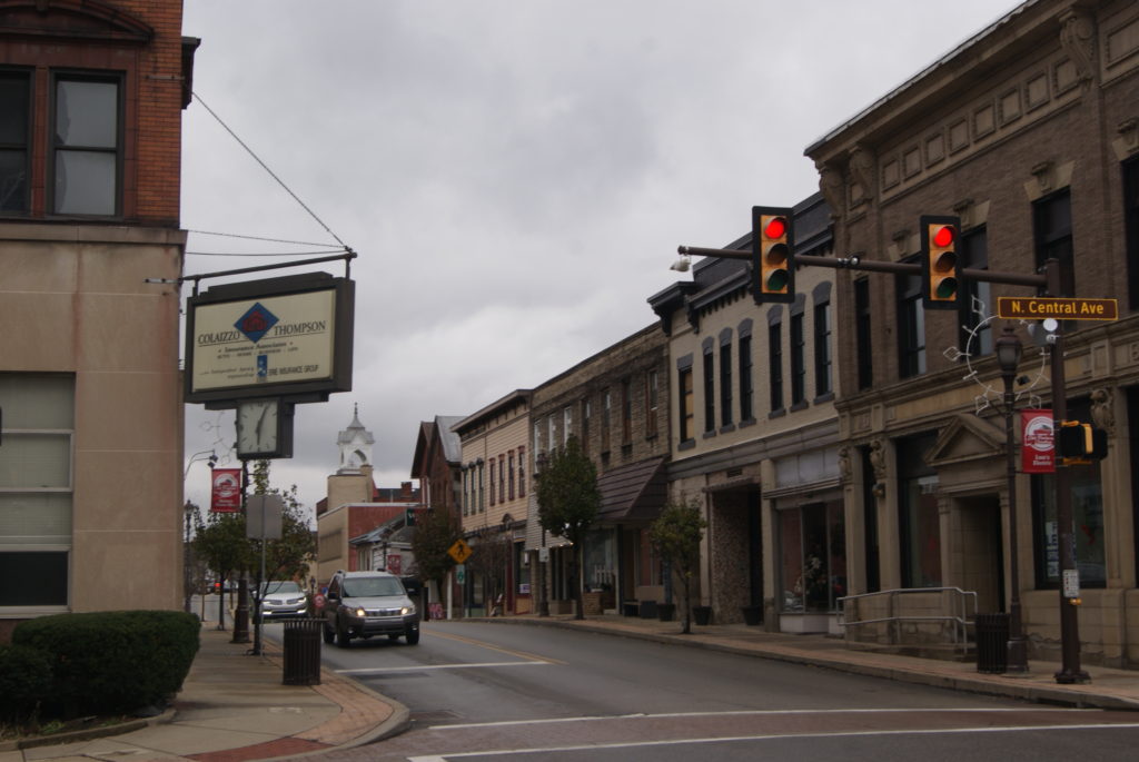
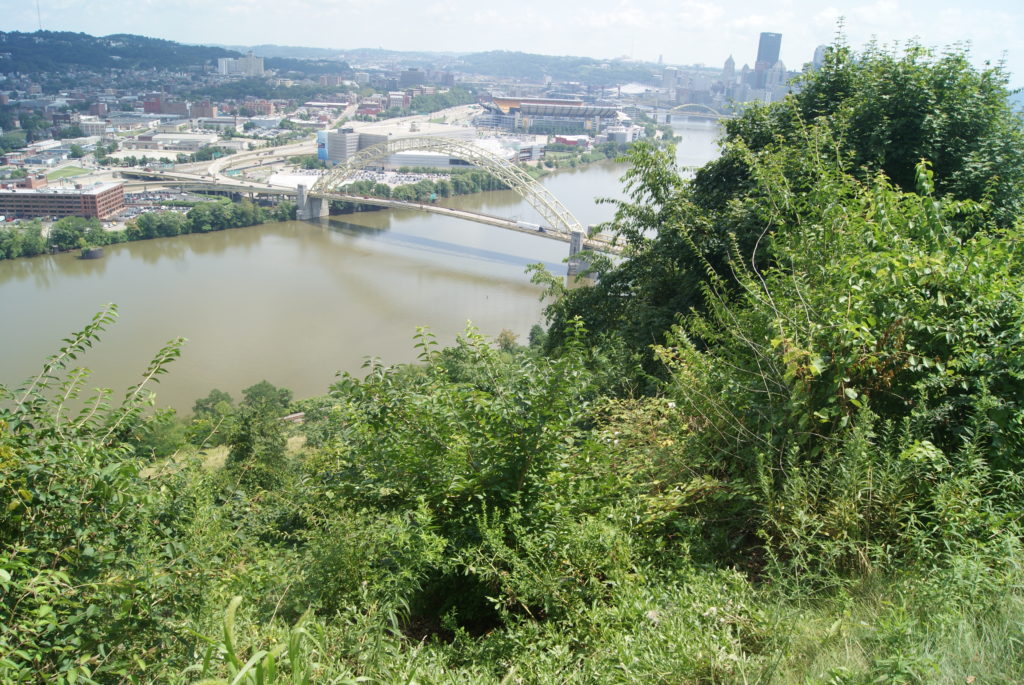
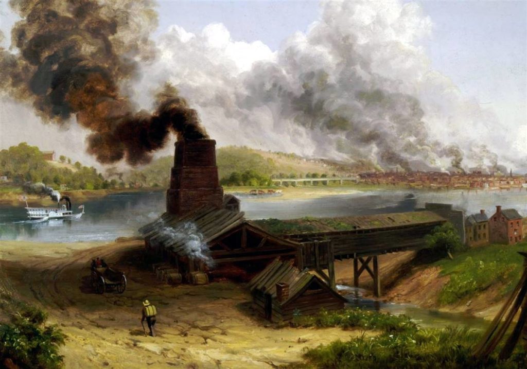
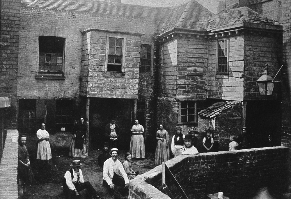
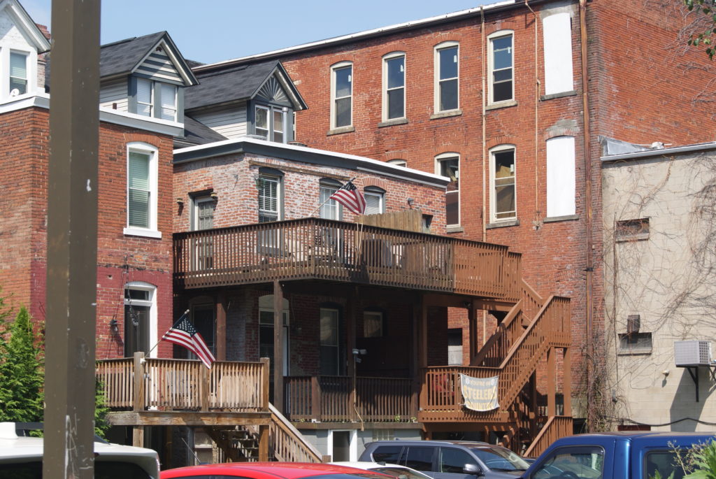
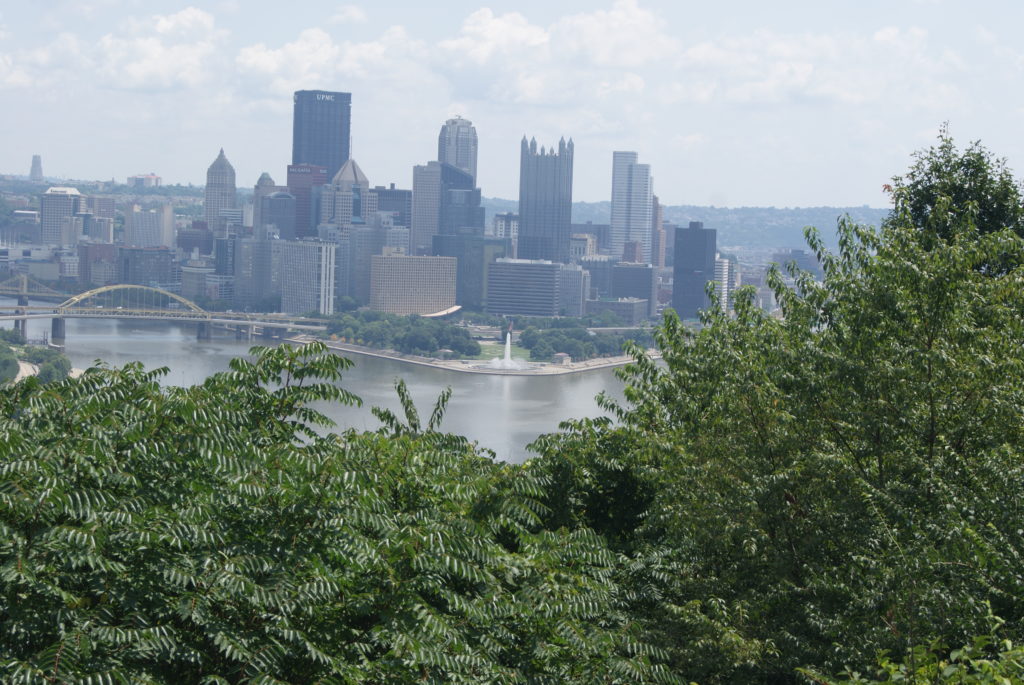
In almost every old industrial town in Appalachia, the rich people populated the hilltops and lived on their capital, the poor people lived on the river flats on their brawn, and the middle-class people lived in the houses that climbed the hills, working as clerks or laborers or running small businesses.

I come from people who clung to the hillsides by their fingernails. 

My ancestors were bookkeepers and barkeepers, laborers, tailors and builders.  They owned furniture stores and barber shops.  When one business failed, they started another one.  They came to America from the Rhineland, Austria and Ireland, and persevered through Depression and war.  The lucky ones had real estate, or the proceeds from selling a business, to provide a retirement income.  Most of them worked until they dropped dead. 

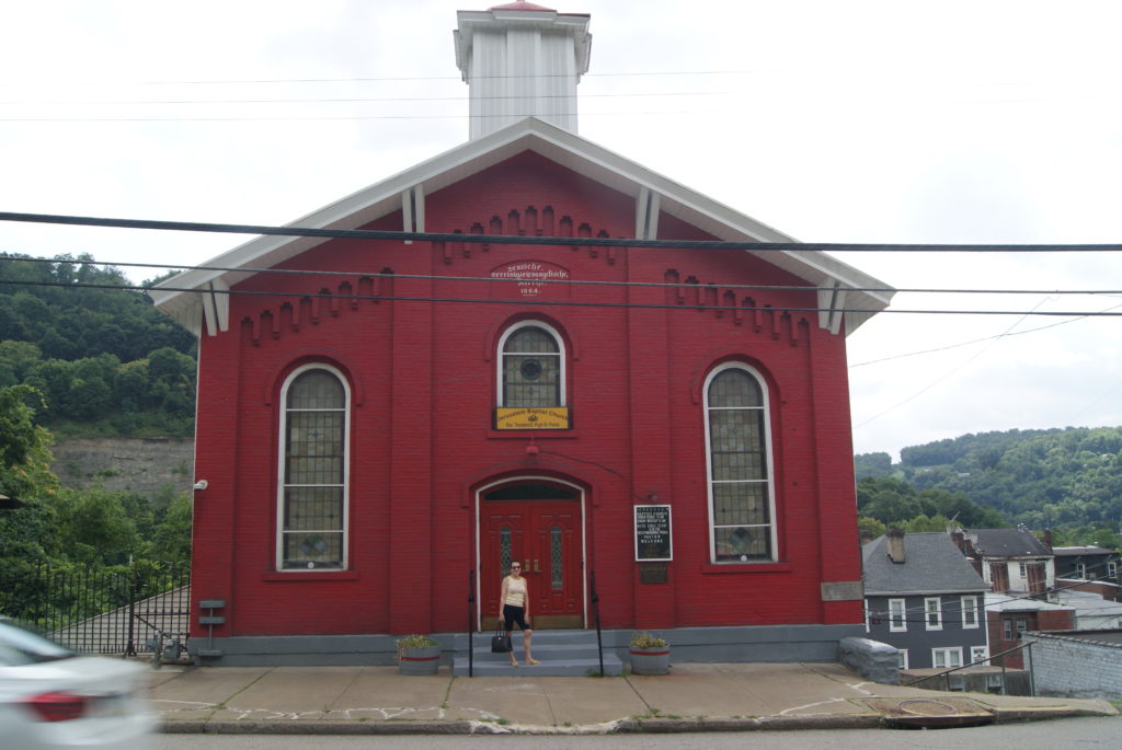
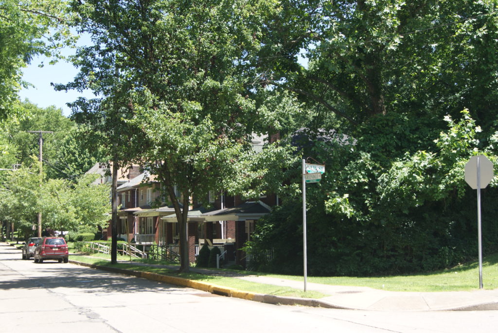
Their lives played out primarily in McKees Rocks (see my previous blog post and The History of McKees Rocks) and Sheraden.  Here are some of their stories….

The Kriegers in McKees Rocks & Sheraden

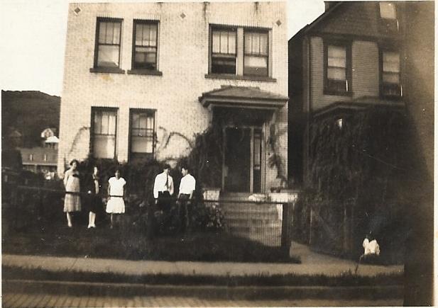
My great-grandfather Frank Krieger was born in Austria in 1878.  His parents immigrated to the United State in 1889 and 1893.  Frank stayed behind and didn’t join his parents in Bridgeville, PA, until 1897.  In 1903, he married Suzanne Steiner, also a native of Austria.  He was a steel mill laborer and did well enough that he bought a house on Merwyn Avenue in Sheraden, where he died in 1936.

Frank and Suzanne Krieger with their 5 children about 1929: Pauline, Edward, Walter, Emma and Wilbert. I think this picture was taken on Merwyn Avenue

My grandfather Walter Krieger was the third of Frank and Suzanne’s five children.  A serial entrepreneur, the business that finally brought him prosperity was as a building contractor.  He bought a second home, a vacation cottage on Pymatuning Lake where our family gathered every summer.  When my parents bought their first house, Grandpap bought all their landscaping plants and helped to establish them, and bought me a swing set for the back yard.  That once-poor carpenter, who was frequently on the brink of insolvency during the Depression, must have been so proud to be able to do those things for his family. 

Grandpap retired to Florida in his 50s after a heart attack left him unable to continue working.  He lived a long life after that, dying in Florida in 1993 at the age of 85.  Grandpap was extraordinarily lucky to survive that heart attack back in the early 1960s.  His father and every single one of his siblings died of heart attacks.

The Marxes in McKees Rocks

Grandpap Krieger lost his father and his first wife in one terrible year in 1936.  My grandmother Margaret Marx Krieger, died of breast cancer at 28, leaving two little boys:  my dad and my Uncle Skip.  Her twin, Aunt Elsie, was an amazing warrior against breast cancer.  Diagnosed in her 30s, she underwent the treatments available in that era. She had her only child a few years later at 40, beat breast cancer AGAIN in her 50s, and lived another 30 years. 
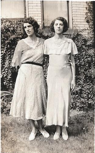
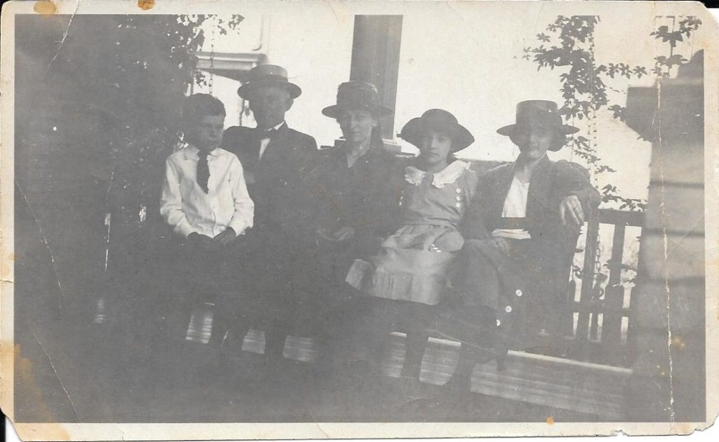
Margaret and Elsie’s brother, Ed Marx, was a vivid, beloved figure in my
childhood.  All the Marx men were tall, thin and fidgety.  If he was
upright, Uncle Ed was pacing.  If he was seated, his legs were crossed and
the top leg was wiggling.  Ed’s brother, Fred, had the same quirk, as did
my father and Uncle Skip. 

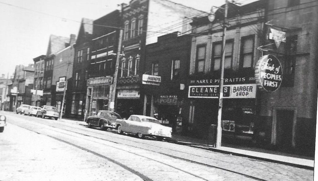
Uncle Ed’s restlessness extended to business.  He and Grandpap Krieger tried a couple of business ventures together during the Depression.  Eventually, Uncle Ed owned a barber shop and dry cleaners in McKees Rocks with a partner (see my previous blog post).  Later, he owned a bar on Chartiers Avenue.  Like Grandpap, he eventually did well enough to retire – although his wife, my Aunt Mary, said that had as much to do with her steady work at the YMCA as with Uncle Ed’s many business ventures!
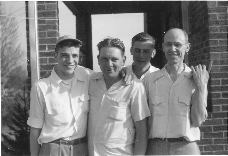
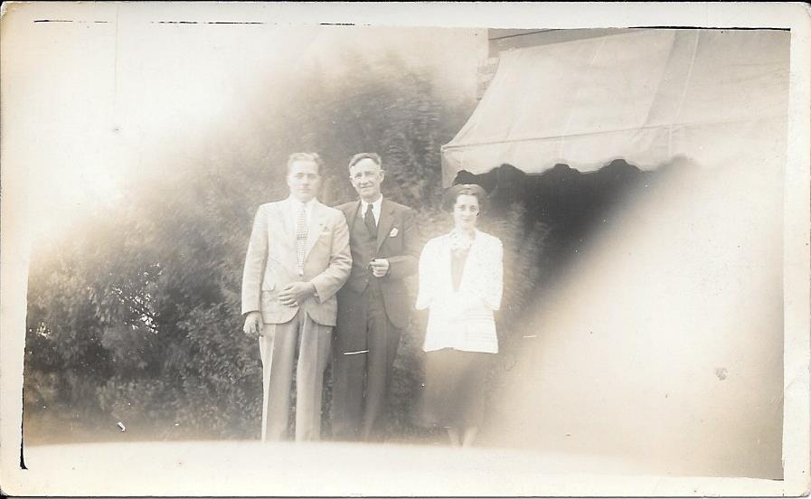
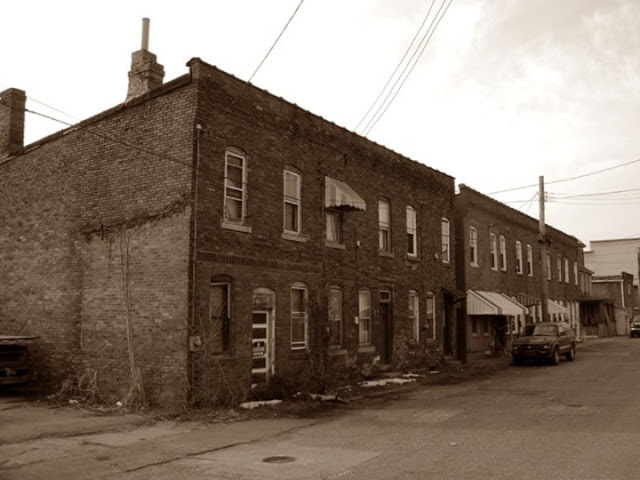
I know less about my Marx great-grandparents than my other ancestors.  Great-grandpap Marx was a tailor in McKees Rocks, and owned an apartment building on Woodward Avenue. My parents rented an apartment from him in the first years of their marriage.  I was born in that apartment on Woodward. 

Great-grandpap Marx’s apartment building on Woodward, where I spent the first 3 years of my life. Not sure who the folks in the picture are.

The Yaggis in McKees Rocks

My mother’s family came from Ireland and Alsace – the province along the Rhine that is German or French, depending who won the last war. 

The Yaggis came from an Alsatian town called Befferen-on-the Rhine.  When Al and I went to eastern France in 2012, we tried unsuccessfully to locate Befferen-on-the Rhine. It’s either been absorbed into a larger town or it was wiped out in one of the wars.  My Yaggi great-great-grandfather, Christian, was born in Befferen-on the-Rhine in 1823. He immigrated to the United States as a young man, settling in Allegheny City and working for a brewer named Lutz on Spring Garden Avenue.  Christian married Anna Kilmeyer and they had 3 children before Christian’s death.   Anna’s second marriage produced 3 more children. 

Christian and Anna’s middle child, Fred, was my great-grandfather.  My mother remembers that he had a German accent, although he was born in Allegheny. He clerked in dry goods stores in Allegheny and the West End, before coming to McKees Rocks and going into the furniture business with his brother-in-law John Yunker, in 1900.  

My great-grandparents, Fred and Mary Yaggi

In 1886, Fred married Mary Linsler, and they had 4 children in a house on Second Street in McKees Rocks.  The eldest, Sylvester, went into the furniture business with his father.  My grandfather, Norbert (called “Nock”), was the youngest. He made his career as a bookkeeper at Duquesne Light, and earned a pension that supported him and my grandmother comfortably until they died.  I loved spending time at their house on Wayne Ave in McKees Rocks when I was a little girl, climbing trees with my Walsh cousins and buying penny candy at Zimmermans. 

Dinner at the Yaggi’s, early 1950s. L-R: Aunt Helen Grant Graham, “Little” Helen Graham, Barbara Graham, Uncle Walter Graham, Grandma Yaggi, Grandpap Yaggi, “Grandma Great”, my mom Roberta Yaggi before her marriage, Richard Yaggi, Mary Graham

Grandpap Yaggi’s VERY Short Military Service

When I was a little girl, I asked Grandpap Yaggi if he ever fought in a war and he said, very brusquely, “No, I was too young.”  But, at his funeral in 1989, my grandmother was presented with an American flag, as the widow of a veteran.  She finally revealed that Grandpap had been in the Army for exactly one day in World War I:  November 10, 1918, with a discharge date of November 11. Armistice Day!  Grandpap longed to enlist for the war but he was young enough to need his parents’ permission, which they refused.  Within weeks of turning 20, he was at the recruiting office, but too late to be a hero.  I finally understood why the war was a sore subject with him.  We have a copy of his discharge papers, and a receipt for his pay for one day’s service:  a grand total of $2. 

The Grants in McKees Rocks

Grandma Yaggi was Mary Angela Grant before she married Grandpap in 1923.  Born in 1901, Grandma was a flapper and bragged about being the first girl in the Rocks to shingle her hair and wear galoshes and short dresses.  Her grandparents, John Grant and Mary Ann O’Neil, were born in Ireland.  They must have emigrated early in life, because her father Michael Grant was born in Ironton, Ohio in 1870.  Grandma’s mother, Margaret Saunders (Sanders in some records), was born in Brady’s Bend, PA in 1869.  It’s not clear how they ended up in McKees Rocks, but my grandmother and her siblings all grew up in the Norwood section of the Rocks. 

The Grant family around 1918 (L-R): Uncle Jack Grant, my great grandparents Michael and Margaret Grant, Aunt Helen Grant Graham, my grandmother Mary Grant Yaggi.

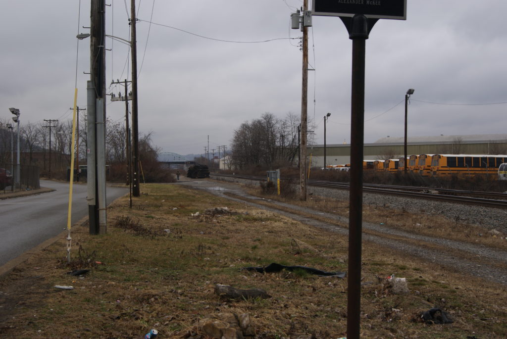
Great-grandpap Grant worked as a laborer in the railyards and mills of McKees Rocks.  Great-grandma Grant – whom we little ones called “Grandma Great” – lived until I was 4 and resided with my grandparents.  I vaguely remember being afraid of her.  She was so terribly old, and didn’t seem to like little children very much.

The Adventures of Uncle Pat

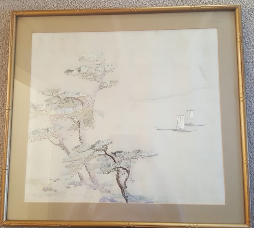
Another person she didn’t much like was her brother-in-law Patrick Grant, who also lived with my grandparents for many years.  Uncle Pat, a railroad worker, took advantage of an opportunity to go to Russia and to help build the Trans-Siberian Railroad. When the Bolshevik Revolution interrupted the railroad work, Uncle Pat had to escape across Siberia and through Japan.  He brought back a beautiful piece of Japanese embroidery that hangs in my living room today. 

Grandma & Grandpap Yaggi with Uncle Pat sometime in the 1930s
The Japanese embroidery that Uncle Pat brought home around 1919

Uncle Pat invested his Trans-Siberian Railroad money in the American stock market at just the right time to become a paper millionaire.  And stayed in the market just long enough to be wiped out.  Destitute, he moved in with my grandparents at about the same time Grandma Great was widowed and moved in with them.  If you ever think you don’t have enough space in your house, consider this:  My grandparents owned a 6-room house during the Depression and had 3 children at the time, as well as a mother and uncle in residence, and – during one unbelievable summer – also Grandma’s sister and her husband and 2 children.  11 people in a 6-room house with one bathroom.  My grandmother used to eat her meals sitting on the cellar steps because there was no room around the table – and no other way to get a quiet moment. 

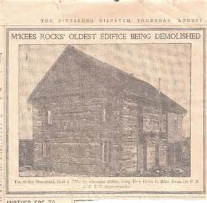
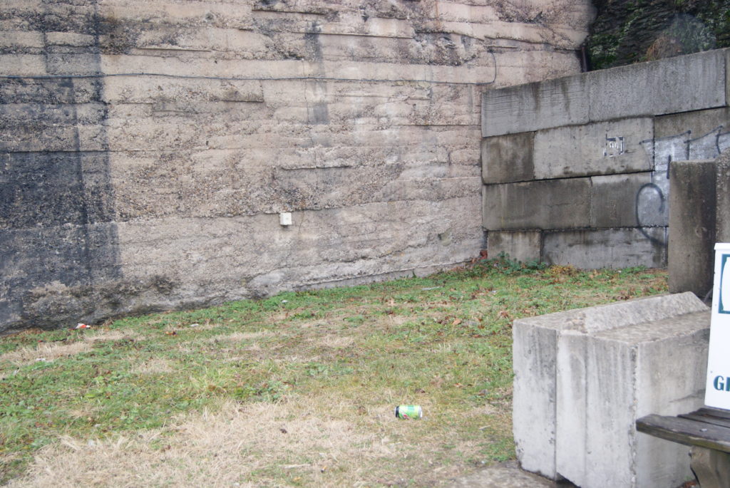
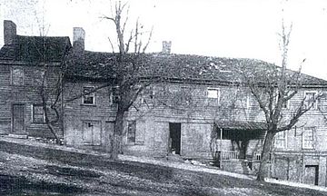
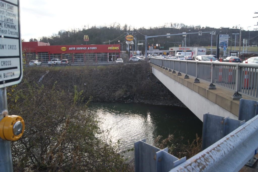
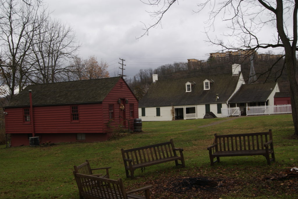
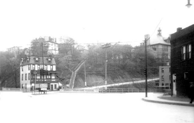
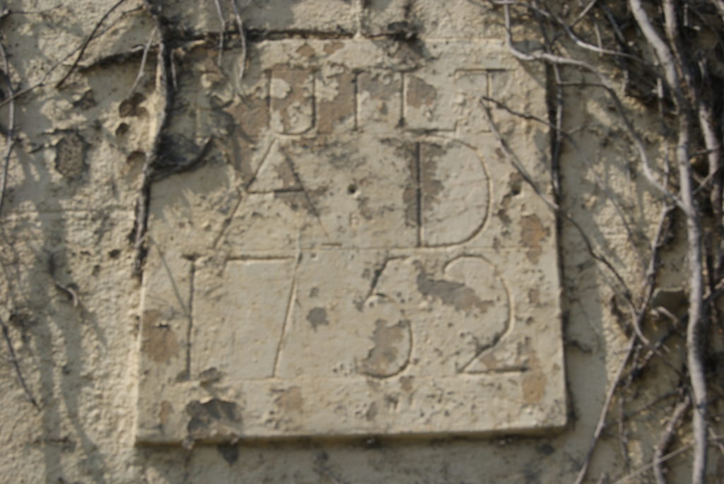
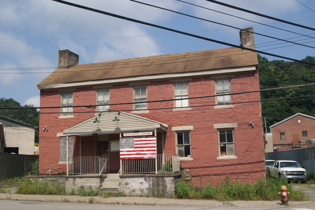
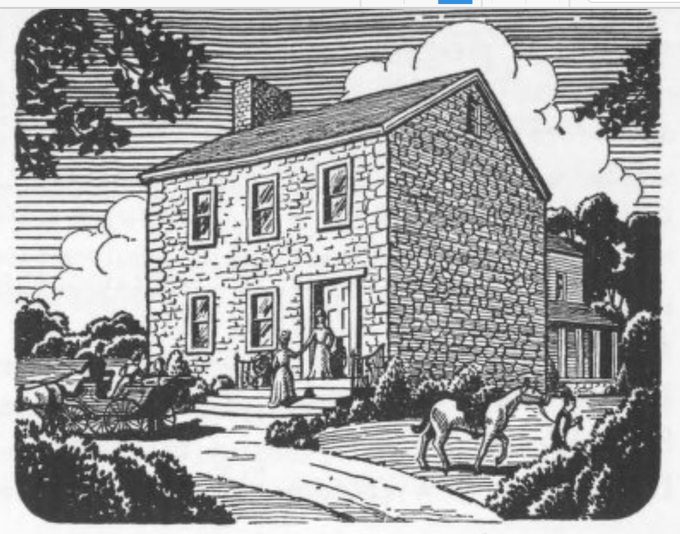
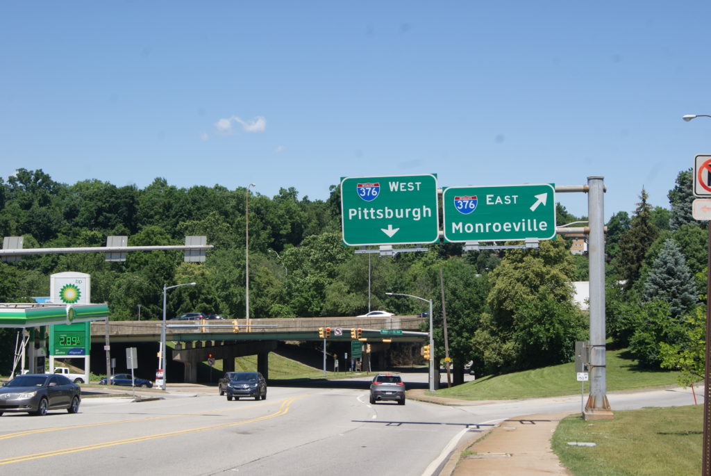
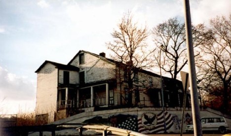
Uncle Pat took what work he could find:  tending bar at Corny Mann’s Hotel, a dilapidated place that slumped on a hill above the Windgap Bridge until about 10 years ago.  The building dated to the late 18th century, and unproven stories claim that George Washington once stopped there.  Uncle Pat took a break from bartending during WW2, to build LSTs at Neville Island, but after the war it was back to Corny Mann’s until he died in the 1950s. 

The infamous Corny Mann’s not long before it was demolished

My family in America

There are gaps in what I know about my ancestors and, like so many recently-retired people in their 60s, I am hoping to find time to fill some of those gaps with research.  So, there may be a follow-up blog post on this topic in a year or two.  But, before I close, I want to preview a tribute to my grandmother, Mary Angela Grant Yaggi, that erstwhile flapper.  I adored Grandma, and she deserves a blog entry all her own.  Watch for that in a couple of weeks.

The story of my ancestors is the story of America, and the story of every industrial town like McKees Rocks.  They failed and tried again and failed again until they succeeded. And they did that in an era when failure meant not unemployment compensation and COBRA, but destitution and eviction.  They sweated over lumber or molten steel, or squinted at ledger books, and built a world where their descendants could be accountants, project managers, auditors, analysts, software developers (LOTS and LOTS of software developers; it is the most common profession among living generations of my family).  The little town where they lived and worked and loved and died to make our lives possible has seen better days. But I’ll always have a deep fondness for the Rocks.  It’s like a grandparent to me:  wrinkled and age-spotted and unlovely, but loved nevertheless for its history and for what it gave. 

Chartiers Creek at McKees Rocks

When I last wrote, Al and I had traced Chartiers Creek from its origins in rural Washington County all the way to Bridgeville.  We are finally at end of our journey, in McKees Rocks, where the creek empties into the Ohio River – and where my own family has deep roots.

Early History of McKees Rocks

The town of McKees Rocks has a long and colorful history.  It was first settled about 5000 years ago.  The very first settlers grew corn and beans in the flatlands along the Ohio River now known as The Bottoms.  They hunted in the forests of the Ohio Valley and fished in the rivers and streams.  We know that they must have fought with other Indians, because they left behind remnants of their arrow and throwing spears.  But their ultimate fate is unknown.

The next settlers of The Rocks were the Adena (800 BC – 100 AD) and Hopewell (100 – 500 AD) peoples, the builders of the once-famous Mckees Rocks mound.  Mound Building peoples settled all across eastern North America, and the McKees Rocks mound was the oldest in Pennsylvania and among the oldest in the country. The mounds were apparently used as both burial places and sites for ceremonial and spiritual rites.  The McKees Rocks mound was surveyed and partially excavated in 1896, and slowly destroyed in the 20th century, by a combination of quarrying and collapse into the Ohio River.  Only the smallest remnant of the Mound can be seen today.

The Mound in the late 19th century

Peter Chartiers got a creek and a township named after him, but it’s Alexander McKee whose name lives on in the town at the confluence of Charters Creek and the Ohio River.

The McKees

In the era after the Mound People, many different Woodland Indians moved in and out of the Ohio River valley.  When the Europeans began trading in the area in the 18th century, the Delaware and Seneca Indians predominated.  The French were the first Europeans to consistently trade with the Indians, most prominently our old friend Peter Chartiers (see my earlier blog post about the West End of Pittsburgh). 

McKee was born on August 14, 1740, in the Pathe Valley, near the Susquehanna River in south-central Pennsylvania.  His father, Thomas McKee, had been a trader along the Susquehanna and later at the headwaters of the Ohio.  Legend has it that his mother spent some of her childhood years in Shawnee captivity, and that is was she who taught him Indian tongues.

On August 17, 1756, young Alexander enlisted in the 3rd Battalion of the Pennsylvania Colony Regiment, and served in the French & Indian War.  Later, he and his father both worked closely with George Croghan, who was put in charge of Indian affairs in the Ohio valley in 1758.  Alexander spoke several Indian languages fluently, and got wind of Pontiac’s uprising in 1863 when he noticed that the Indians had started trading their furs for lead and gunpowder.  He warned Croghan of the coming uprising, and was in charge of all communications with the Indians during the siege of Pittsburgh in June and July of 1763.

After the battle of Bushy Run resulted in Pontiac’s defeat, Colonel Bouquet rewarded McKee with a 1400-acre estate, including all of present-day McKees Rocks and a strip of present-day Pittsburgh on the west side of Chartiers Creek.  McKee was also named commissary at Fort Pitt, a post that he held until the British abandoned the fort in 1772.  After Pontiac’s war, McKee also resumed his trade with the Indians and became the Indian agent for the area.  His estate prospered and he entertained George Washington for dinner in his grand house called Fairview on October 20, 1770.

This picture of George Washington and Christopher Gist meeting with Delaware Indians at McKees Rocks used to hang in the PNC Bank branch on Chartiers Avenue .
Alexander McKee’s mansion Fairview, before it was razed by the P&LE Railroad in 1902.

But with the coming of the American Revolution, McKee’s luck changed.  He sided with the Tories and was run out of the town that bears his name in March of 1778.  His estate was taken over by his brother, James, who had backed the right side.  James lived on the estate until his death in 1853.

Alexander made his way to Detroit, where he worked as a liaison between the Delaware Indians and the British.  Later, he was appointed Superintendent for Indian Affairs in Canada and moved to Ontario.  He died in Maldeen, Ontario, on January 14, 1799.

Recent History of McKees Rocks

In the decades that followed, the McKees’ namesake town prospered into a railroad and manufacturing center, home to the Pittsburgh & Lake Erie Railroad, the Pressed Steel Car Company, the Shoen Works of Carnegie-Illinois Steel, and many other thriving industries.  19th-century immigrants to the Rocks were mainly from Germany, but in the first half of the 20th century, immigrants from eastern and southern Europe poured into the rail yards and factories of McKees Rocks.  They settled in row houses in The Bottoms along the Ohio. 

Housing in McKees Rocks Bottoms mid 20th century.

The Rocks in the early 20th century was a bustling little town, boasting at least two movie theaters, several grocery stores and supermarkets, a skating arena, and the dry cleaners, bakeries, and other little shops that allowed people of that era to thrive running their own small businesses.  My family has home movies of a Little League parade in the early 1960s.  The population of the Rocks was so large and active that they fielded several teams who never had to leave the Rocks for opponents to play.  I remember going to my cousins’ games where dust rose from the parched fields and the smells of diesel fuel and burning coke were the perfume of prosperity.  My own family’s history is very bound up in McKees Rocks’ glory days, and I will be blogging about that next time.

Like so many industrial towns, McKees Rocks’ fortunes declined in the late 20th century.  The factories closed, the P&LE Railroad shrunk and was finally sold, and the little businesses along Chartiers Avenue and Broadway slowly began to close.  The dry cleaner where my father worked as a teenager burned down about 20 years ago, and the shell is still a charred gap on Chartiers Avenue. 

My Uncle Ed Marx owned the Marx half of Marx & Petraitis Cleaners/Barber Shop pictured here in the late 1950s. My dad worked there as a teenager.

But the community is fighting back hard.  For 50 years, the Focus On Renewal organization has been providing social services such as a food pantry, early-childhood education, mental health support services, arts programs and small business incubation.  Some steel fabricating factories remain, CSX Railroad has increased their presence, the Roxian theater has re-opened, and the community is known for Pierogies Plus and Mancini’s Bakery.  I liked to think that old Peter Chartiers and James and Alexander McKee would be proud of their community’s tough, resilient spirit. 

Sources:

Images of America:  McKees Rocks and Stowe Township – Bernadette Sulzer Agreen with the McKees Rocks Historical Society

https://historicpittsburgh.org/islandora/object/pitt%3A31735066234331/viewer#page/1/mode/2up

Chartiers Creek Part Two

Recently, in our search for interesting Western Pennsylvania history, Al and I have been following local creeks and runs. When we left Chartiers Creek in my last blog post, it had turned into a robust waterway in Houston, PA.  On a blustery November day, we rejoined the creek just north of Houston in Canonsburg. 

Chartiers Creek in Canonsburg

Named for its first settler, John Canon, who arrived in the area in 1773, Canonsburg is almost as old as Pittsburgh.  Legend says that George Washington passed through in 1777.  The town’s first main street, Pike Street (also known as the Pittsburgh-Washington Pike) was laid out in 1787.  A grist mill stood on the creek along present-day South Central Ave. just south of the pike.

The current grounds of Canon-McMillian High School were once the site of the Black Horse Tavern.  In the 18th century, the Pittsburgh-Washington Pike was sometimes known as Black Horse Road, and the tavern was surely named after the road. Founded in 1794 by Henry Westby, the remains of the tavern still stood until the high school was built in 1958.  During the Whiskey Rebellion in 1794, local rebels met at the tavern to plan attacks on federal forces.  They also intercepted mail coming to the federal leaders from Philadelphia.

Canonsburg was also the home of Jefferson College, originally a sister school to Washington College in Washington, PA.  Both schools ran into financial difficulties during the Civil War, and they merged in 1865, forming Washington & Jefferson College.  The home of one of the Jefferson College founders still stands:  John McMillan’s 1780 log house is preserved on East College St.  Nearby stands the Roberts House, whose original wing dates to 1802. 

Home to coal mines and steel mills in the 19th and 20th centuries, Canonsburg is best known in the 21st century for Sarris Candy and All-Clad kitchenware – and for its Independence Day parade.  The town of about 9000 residents attracts as many as 60,000 for its elaborate parade.

The Lake and Montour Trail

After a very pretty drive out of Canonsburg, the creek sprawls into Canonsburg Lake before slimming down into a river again as it enters Allegheny County.  Alcoa Corp. created the dam and lake in 1943 to create a freshwater reservoir for their Canonsburg Forging Plant. The Pennsylvania Fish and Boat Commission acquired it from Alcoa in 1957.  

We stopped on our way north and hiked a little way on the Montour Trail for some lovely views of the creek.  It is shallow in this section and ripples over rocks very prettily.  Let’s just say that our car desperately needed a wash after the drive to the trail head parking off Linwood Road.  I recommend parking at a different trail head if you’re fussy about your car, but it was worth it to us for the views of the creek.

Chartiers Creek in Bridgeville

The creek follows its crooked path behind Queen of Heaven cemetery and through Forest Valley golf course before entering Allegheny county near the border of South Fayette and Upper Saint Clair townships.  It then enters another old town that is named for the first bridge to cross the creek:  Bridgeville.  The bridge went up some time in the 1790s, and references to “Bridgeville” appear in newspapers by the 1830s.  Here is a link to an excellent article that provides details of how the bridge came to be at that location.

The bridge sparked growth in the little town that bore its name. It soon boasted forges, factories and a woolen mill at the corner of Bank St. and Washington Avenue (Pittsburgh-Washington Pike).

After our long drive and our hike, Al and I felt hungry, so we stopped for a late lunch at LaBella Bean.  Yummy chai latte and ham-and-brie panini with raspberry jam!

Chartiers Creek in Scott Township

As I said in my last post, wherever you see a creek in Western Pennsylvania, you can be sure that a coal mine operated not far away, and that proved true as we entered Scott Township on our drive.  We spotted a mine entrance right on Bower Hill Road. 

Scott Township and Mt. Lebanon split off from Upper Saint Clair Township in 1860.  By 1883, coal mining was Scott’s main business.  A partial list of mining companies includes Glendale Colliery, Nixon Mines, Diamond Mines, Summer Hill Mines and Bower Hills Mine (probably the one we saw).  The community also boasted a bottle factory, Leasdale Glass, and the Chartiers Valley Railroad, which serviced the mines. 

John Neville’s homes both stood in Scott.  A Virginia native, Neville arrived in Pittsburgh in 1774 to command the Virginia troops at Fort Dunmore (later remained Fort Pitt), and started construction of his home, Woodville, around the same time.  His home at Woodville survives on Washington Pike and was occupied until 1975.  The house opens for tours only on Sundays, but Al and I spent an enjoyable hour poking around the grounds.

Neville later built another home, Bower Hill, near the current location of Kane Hospital and Our Lady of Grace Church.  At the time, Neville was one of the largest landowners in Western Pennsylvania.  He owned 10,000 contiguous acres in present-day Mt. Lebanon, Scott, Carnegie, Rennerdale and Bridgeville.

In this neighborhood, however, you can’t get away from the Whiskey Rebellion any more than you can get away from coal miles.  Neville was on the “wrong” side of the Whiskey Rebellion and the rebels burned Bower Hill during the rebellion in 1794.

Al and I have spent two full days exploring Chartiers Creek, and we’re still not done!  Stay tuned for the twists and turns of the creek as it makes it was through Carnegie and Crafton and finally empties into the Ohio River at McKees Rocks. 

Sources

https://en.wikipedia.org/wiki/Canonsburg_Lake

http://history.rays-place.com/pa/wash-canonsburg.htm

https://en.wikipedia.org/wiki/Canonsburg,_Pennsylvania

http://www.bridgevillehistory.org/

http://www.bridgevillehistory.org/waterunderthebridge.html

Plum Run before it merges with Chartiers Creek

Chartiers Creek

Al and I had so much fun driving the course of Saw Mill Run that we decided to take on a bigger challenge:  Chartiers Creek.  Saw Mill Run, with a watershed entirely within Allegheny County, is only about 9 miles long.  Chartiers Creek runs a 38-mile course in Washington County before it even flows into Allegheny County, where it empties into the Ohio River.

The creek and the former Chartiers Township, from which many western Allegheny County townships were formed, were named for Pierre (or Peter) Chartiers, a half-French, half-Shawnee trader who established a trading post on the creek in the early 1730s.  (Learn more about Peter Chartiers here).

Chartiers Creek in Rural Washington County

Al and I started our drive on a beautiful fall day that showed off rural Washington County at its best.  Those who can afford to do so build their homes on hilltops with huge banks of windows that look out on the rolling green hills of farmsteads, winding tar-and-chip country roads, and trees ablaze in gold, bronze and red. 

The creek is born as a tiny trickle along Route 18.  A couple of miles along, it is still a very tame little stream as it wanders through the golf course of the Lone Pine Country Club.  In North Franklin Township, it starts to gain steam, fed by another trickle from a large reservoir.  It then passes through the county seat of Washington, PA.

Al said the roads reminded him of Ireland: two lanes but only one car wide!
One stunning view in beautiful rural Washington County
Chartiers Creek’s humble beginnings
Nice and tame through Lone Pine golf course

Chartiers Creek in Washington, PA

Washington is one of the many medium-sized towns in western Pennsylvania that prospered in the 19th and early 20th centuries, but have since suffered from the decline of heavy industry, the rise of suburban sprawl and malls, and then the age of internet shopping.  For a while, the county offices and Washington & Jefferson College seemed to be all that kept it afloat.  But Washington is fighting back (see this recent article in the Pittsburgh Post-Gazette).  They’re making the most of their Whiskey Rebellion and abolitionist heritage by maintaining the LeMoyne House and the Bradford House.  Wineries, breweries and distilleries have opened in the past few years.  Al and I toured the Liberty Pole Distillery a couple of months ago with our daughter and son-in-law, and I highly recommend the tour and tasting. 

During our Chartiers Creek drive, Al and I had lunch at the Union Grill in downtown Washington.  It has a bit of a speakeasy vibe, with its art-deco stained glass, and the entrance at below street level.  Pictures of Washington County history hang on the walls.  Al’s steak sandwich and my chicken & artichoke pizza were very good, and their house-made chips were the best we’ve ever had:  super-crisp with just the right amount of salt. Our server, Debbie, was personable and friendly, and sent us home with an extra box of chips at no charge!

Union Grill in Washington. If you go, definitely order a sandwich so you can get some of their amazing house-made chips!

The creek itself is still shallow and kind of lazy in Washington, but it starts gaining some muscle near Houston, PA, where it is fed by Plum Run and Chartiers Run.  By the time we left it in Canonsburg, it looked like a real-grown-up river.  It was mid-afternoon when we drove through Canonsburg, and we’d started our drive at mid-morning, so we decided to call it a day and head for Route 79.  After our meander down the country roads of Washington County, we were ready for the express route home. 

Chartiers Run before it merges into Chartiers Creek
Plum Run
Our little creek is more of a river when it reaches Houston, PA. Look how beautifully it reflects the sky and trees above!
Also: ducks!
In western PA, where there is a stream, there will be a coal patch. Here’s a big one outside Houston.

But we’ll be back to drive the rest of the creek’s route through northern Washington County and Allegheny County, all the way to my birthplace, McKees Rocks, where it joins the Ohio River.  Stay tuned! 

Sources

http://www.co.washington.pa.us/233/County-History

https://en.wikipedia.org/wiki/Peter_Chartier

Saw Mill Run

Saw Mill Run has figured in two of my blog posts about lost Pittsburgh towns.  So, Al and I thought it would be interesting to drive the 9-mile length of it and learn a little bit of the history of the towns the live along it. 

First, why is it called a “run” and not a “creek” or a “stream”?  We have our English and German ancestors to thank for that.  The word “run” is related to “ryne” in Old English, “runnen” in Middle Dutch, “irnan” in Old Saxon and “rinner” in Old High German. 

Famously flood-y after a heavy rain, Saw Mill Run was an unprepossessing trickle at the end of a very dry September.  In the past, its banks were home to a salt works, coal patch towns and the saw mill that gave it its name. 

Saw Mill Run in Bethel Park

The Run starts in the backyard of a house on Casswell Drive in Bethel Park, but it is culverted for about its first half mile as it passes under backyards on Casswell and Cassidy Drives.  It emerges as a visible stream near the Caswell T stop, in a little wood among birdsong, thrashing deer and flitting yellow butterflies.  It flows openly along Milford Road for less than a mile, before culverting again at the Washington Junction T station.  There, we also saw some houses that dated back to one of the many coal patches that once thrived in the South Hills.

Here is where Saw Mill Run is first visible
Old coal patch houses near Washington Junction

Saw Mill Run in Castle Shannon

The stream emerges once again just north of Washington Junction, and gurgles obediently through sluices between T tracks and the backyards of Canal Street until it sprawls again near St. Anne’s School.

Here Saw Mill Run is very neatly controlled
But it sprawls a little more further into Castle Shannon

Culverted under downtown Castle Shannon, the stream again sees daylight starting at the corner of Library Road and Castle Shannon Blvd., near Mindful Brewing and Williams Stained Glass, watched over by a banner honoring a son of Castle Shannon who was killed in Viet Nam in 1969. 

I felt like this hero was guarding the stream as it flows near his banner

At the corner of Library and Grove Roads, where the Sunoco Station and the St. Vincent De Paul Thrift Store stand today, a large greenhouse business once thrived.  It was the second-largest employer in Castle Shannon at one time, second only to the coal mines. 

This large greenhouse business was one of the biggest employers in Castle Shannon

A little further on, the Run trickles past Memorial Hall T Station and historic Linden Grove.  I can remember going to dances at the Grove as a teenager, when it stood on stilts above its often-flooded gravel parking lot, and smelled like an old boat house.  The Grove dates back to 1872, when the Pittsburgh-Castle Shannon Railroad created it as an “amusement grove” to draw more fares from the city into the suburbs. 

I have many fond memories of dancing at the Grove
The stream bed was almost completely dry near the Grove on the day we did our drive.

A little further down Library Road all that remains of another coal patch is a bar marking the old entrance to the mine shaft, and the steps that used to lead to miners’ housing on the hillside across the street.

The Coal Mine tavern near old mine entrance
Old steps that led to miners’ housing
Children standing in front of patch town houses in 1920s

Saw Mill Run many times naughtily overflowed its banks at the intersection of Library Road (Route 88) and Saw Mill Run Blvd. (Route 51), before the state Department of Transportation enlarged the culverts and improved the interchange several years ago. 

Junction of Saw Mill Run Blvd. and Library Rd. today
It was a lot quieter in 1933

Saw Mill Run in Brookline, Overbrook and Bon Air

I wish I could say that our drive was a pleasant one, but if Library Road is a featureless show of strip malls, the scenery gets even uglier when the Run makes its bend onto Saw Mill Run Blvd.  The Run’s namesake road is a miserable slog of decrepit houses, one used-car lot and car-parts store after another, other dispirited-looking small businesses, and traffic as clogged as the arteries of some cranky old man who’s been eating nothing but cheeseburgers for 40 years.  In the span of 20 minutes, we witnessed a truck accident at the Co Go’s and an altercation in the parking lot of the Red White and Blue Thrift Store, and got caught in chaotic quitting-time traffic coming out of the Advance Sign factory.  Oh, and you don’t see a car carcass in just any stream.

I’d love to know the story behind this
Corner of Saw Mill Run Blvd. and Nobles Lane today
There was a gas station there in 1936 too

Saw Mill Run in Beechview

Seldom Seen Greenway seems like an oasis after the hell of Saw Mill Run Blvd between Library Road and Woodruff St.  Here, the Run trickles merrily through a lovely wood right in the middle of the city.  See my blog entry from April 28 on Seldom Seen (formerly Shalerville) for more details about this pretty greenway. Here are a few pictures of the Run in its much more natural habitat.

Pretty little waterfall in Seldom Seen.
So pretty!
Saw Mill Run in its natural habitat.

Saw Mill Run in Banksville and West End

From Seldom Seen, the Run passes under the Rt 51/376/19 interchange and emerges into West End, another place where it has caused all kinds of trouble in the past.  Al and I spent a very nice day exploring the West End (formerly Temperanceville) earlier this summer (see this blog entry).  We walked the length of the Run in the West End, all the way to where it culverts under West Carson Street and the railroad tracks.  Where it spills into the Ohio River, near the West End Bridge, is where the saw mill that give it is name once stood.  That saw mill almost certainly supplied the lumber for Fort Pitt.  Later, in the early 19th century, a salt works stood there.     

I’ve spent my whole life living within a couple of miles of this humble little stream that has seen so much history and been so abused.  Now that I’ve seen every inch of its 9 miles that is viewable, I feel kind of protective!

This is the last view of the Run before it culverts under West Carson Street and the railroad tracks and empties into the Ohio.
Right below this view is where Saw Mill Run spills into the Ohio
Salt works at the confluence with the Ohio, 1834.

SOURCES

https://www.wesa.fm/post/why-are-there-so-many-run-roads-pittsburgh-region#stream/0

http://www.brooklineconnection.com/history/Facts/SawMillRun.html

http://www.brooklineconnection.com/history/Facebook/SawMillRun.html

Here’s a Rick Sebak show about Route 88 that tells a little more about the history of part of the Saw Mill Run watershed.  We’ve seen the play about the armored car heist in Bethel Park in 1927; it was really good: https://www.youtube.com/watch?v=94jJNLXyNgg

Temperanceville

In my last post, I blogged about the Pittsburgh area’s oldest tavern building.  This week, I continue with the history of the neighborhood where the Old Stone Tavern stands.  The history of Old Temperanceville is both fascinating, and very, very typical of Pittsburgh communities.    

19th century map of Temperanceville

Early Temperanceville History

The present-day West End of Pittsburgh was part of St. Clair Township in the 18th century.  In 1800, the northern and western sections of St. Clair broke off into Chartiers and Union Townships.  Much of the land in Chartiers was owned by a gentleman named West Elliott (yes, the Pittsburgh neighborhood of Elliott is named for his family).  Mr. Elliott was a gambler and he sold the land encompassing present-day West End in 1835 to pay off gambling debts.  The new owners, Isaac Warden and John Alexander, laid out the town of Temperanceville in 1837.  The deeds to the lots that they sold included a clause stipulating that no liquor may be sold on the parcel, or the lot would revert back to Warden and Alexander.  Nevertheless, by the mid-1800s, several saloons flourished in Temperanceville.

The little town grew quickly.  Businesses sprouted up to support the nearby coal mines, blast furnaces and iron mills.  By the 1870s, Main, Wabash and Steuben Streets were paved roads, and Temperenceville businesses included the Sheffield Iron Works, Haller & Beck Salt Works, Duff’s Sawmill, Wood’s Rolling Mill, Hall’s Plow factory, Wightman Glass, and Taylor Salt & Chemical.  A coke oven operated at the corner of Main & Woodville Streets. 

The Slums of Temperanceville

This is not a photo of the slum area of Temperanceville, but it is a good depiction of what a 19th century slum looked like.

Life in a boom town isn’t always pleasant.  The town flooded frequently, most catastrophically in 1874. Most of the streets were still dirt, and turned to rivers of mud after a rain or snow.  Cows and chickens roamed the streets and free-ranging pigs rooted in the garbage.  Sensible people knew to avoid the shantytown along River Road (present-day West Carson Street) at night.  One woman who often had to go back and forth between West End and downtown Pittsburgh described it this way: “It required considerable courage to make a trip in comfort and safety to Saw Mill Run after nightfall…the only illumination after leaving the Smithfield Bridge came from the glare of the blast and puddling furnaces…the absence of gas lights and police in this district made it a refuge for toughs, who were dangerous to meet at all times, but particularly so after they had received a pay and were full of drink…Needless to say, if a passerby happened to get killed, it was an easy matter to throw his body into the river.”

Late 19th-century housing

A local official described the slum housing that climbed up the hillside from the Ohio River:  “half a thousand people living there under conditions that were unbelievable – back-to-back houses with no through ventilation; cellar kitchens; dark, unsanitary, ill-ventilated, overcrowded sleeping rooms, no drinking water supply on the premises, and a dearth of sanitary accommodations…In one apartment, a man, his wife, and baby, and two boarders slept in one room, and five boarders occupied two beds in and adjoining room.  In another apartment of the three rooms, the man, his wife and baby slept in the kitchen, their two boarders in a second room; and the third room was sub-let and occupied as a living and sleeping room by five persons – a man, his wife and child, and two boarders.”

The single water pump in this section served 91 households, a total of 568 people.  It was located 75 steps below the top row of houses.  Drainage chutes for both storm water and human waste dropped to open wooden gutters running between the houses. 

Temperanceville Becomes West End

Temperanceville was absorbed into the City of Pittsburgh in 1872, and continued to grow, from a population of 2768 in 1880 to 3725 by 1900.  Slavs, Hungarians, and Poles joined the English, Irish and Germans in the neighborhood.  Small industries gave way to commercial buildings like banks, shops and real estate offices.  The West End became a shopping, transportation and entertainments center for the Crafton/western Pittsburgh area.  Wooden houses were replaced by the tall brick row houses seen today in the neighborhood.  The West End boasted many social clubs, fraternal lodges, churches, choral and drama societies, and a dance school and baseball league. 

German Evangelical Church dates to 1864. Now the Jerusalem Baptist Church
Late 19th-century buildings.
Some beautifully restored 19th-century architectural detail

The neighborhood endured a period of decline in the late 20th century, but shows signs of bouncing back.  The lovely old Carnegie Library, dating to the 1890s, still stands and is a lively community hub.  Local businesses include a yoga studio, a stone and tile showroom, an art gallery and an antique store.  I had a delicious vegetarian panini and iced chai latte at Café 412, a pretty little coffee shop in Main Street.  Life in old Temperanceville sure has improved since the days of wooden gutters and wandering pigs!

West End is one of the earliest Carnegie Library branches, dating to the 1890s.
Charming Cafe 412 serves a great lunch at a reasonable price.
A nice side trip from West End takes you up to the West End Overlook, for a slightly different view of the Point than what you get from the more-famous Mt. Washington.

Sources

A special shout-out to Emily Ahlin and Maria Joseph of the West End branch of Carnegie Library. The history closet at the West End branch was a wealth of information. Thanks!

Lawrence, Peter, A Geographical History of West End and Elliott and the Neighboring Southwest Pittsburgh Area: City of Pittsburgh Planning Department, 1973.

Fording, Arthur M., Recollections and Reminiscences of West End – Pittsburgh, PA: Self published circa 1950.

Pittsburgh’s Oldest Tavern

Early History of Temperanceville

In our search for lost Pittsburgh neighborhoods, Al and I recently visited old Temperanceville. The community was founded on temperance but is also the home of Pittsburgh’s oldest tavern building.

19th-century map of Temperancville (present-day West End)

The American Indians seldom traveled to the area that would later become Temperanceville and then Pittsburgh’s West End.  They preferred the mouth of Chartiers Creek in modern-day McKees Rocks.  Like all of western Pennsylvania, the site of Temperanceville was disputed territory in the 1750s, claimed by both the British and the French.  Traders from both countries tramped the wooded hills and rafted up and down the rivers and creeks, trading with the Indians.  One of the earliest traders was Peter Chartier a Frenchman who lent his name to Chartiers Creek and the former Chartiers Township from which Crafton, Sheraden, Temperanceville and other western communities were formed.

The history of Temperanceville predates our nation.  Before the American Revolution, the mouth of Saw Mill Run was the home of the saw mill that almost certainly supplied the lumber for Fort Pitt.  In our nation’s earliest history, the area also boasted a boat yard, stables and an inn. These would have been conveniences for travelers heading south on Washington Pike or west on Steubenville Pike.  The inn, The Old Stone Tavern, still stands and is one of the oldest buildings in the City of Pittsburgh.

History of the Old Stone Tavern

Most historians don’t think so!

Architectural historians dispute the age of the Old Stone Tavern.  The cornerstone gives a date of 1752, but that is probably inaccurate.  1756 is another proposed date, but that is also suspect.  Few Europeans settled the area before the 1760’s and the French & Indian war raged in the 1750’s.  It seems unlikely that anyone would have made the investment to put up a stone building in the middle of a war zone. In pre-Revolutionary Western Pennsylvania, most all buildings in Western Pennsylvania were log or frame. Stone would have been an expensive luxury. 

Dates as late as 1819 were proposed until a ledger from the tavern was found, with entries starting in 1793.  Current consensus is that the Old Stone Tavern was built sometime between 1782 and 1793. An addition on the back dates to the Civil War era.  Perhaps the cornerstone refers to a humbler tavern building that first stood on the site. 

The Old Stone Tavern today

The tavern has a colorful history.  The ledger helped to establish as fact the legend that the it was a meeting site for members of the Whiskey Rebellion.  The ledger lists the names of 89 Whiskey Rebellion participants, as well as 109 known veterans of the American Revolution, and 16 known veterans of the War of 1812.  President Grant visited the tavern in 1869. 

Less proven are rumors that George Washington, Arthur Saint Clair and Charles Dickens slept at the tavern, along with a legendary duel fought there in the early 19th century.  Also unproven are the inevitable ghost stories. Ghost stories center around the use of a small room in the tavern as a holding cell for prisoners being transported along the Washington Pike. 

The tavern operated continuously from circa 1782 until 2008.  It was a toll plaza for the Washington Pike, a stage coach stop, a social center, reputedly a brothel for a time, and a Prohibition-era speakeasy.  Dog fights, political rallies and boxing matches were held there.  It just missed destruction in a refinery fire in 1873. The 1874 Saw Mill Run flood swept away a grocery store only a block away but merely licked the tavern. 

As a young girl growing up in Banksville and riding the old 36C West End Greentree bus out of downtown, I passed The Old Stone Tavern many times and never noticed it. Reading a book or daydreaming about boys.  I had no idea that a piece of lively Pittsburgh history passed right outside the bus window .

The Future of the Old Stone Tavern

The tavern was designated a historical landmark in 2009, and the Pittsburgh’s Old Stone Tavern Friends Trust is raising funds for an ambitious project to restore the old building into a restaurant and tavern.  Plans for the tavern and surrounding area also include a museum, distillery and tasting room, and community green space.  Find out more HERE.

Coming Next on the Blog

COMING SOON:  More Temperanceville history, our trip to Temperanceville, and tracing the path of Saw Mill Run.   

Sources

A special shout-out to Emily Ahlin and Maria Joseph of the West End branch of Carnegie Library. The history closet at the West End branch was a wealth of information. Thanks!

Lawrence, Peter, A Geographical History of West End and Elliott and the Neighboring Southwest Pittsburgh Area: City of Pittsburgh Planning Department, 1973.

Fording, Arthur M., Recollections and Reminiscences of West End – Pittsburgh, PA: Self published circa 1950.

Informational flyer from Pittsburgh’s Old Stone Tavern Friends Trust

Wilkinsburg’s One-Room Schoolhouse

Jane’s schoolroom probably looked a lot like this, since it was in a room of her mother’s house.

Jane Grey Swisshelm held several jobs in her lifetime.  Her father died when she was only 11 years old and her family was plunged into poverty.  Jane had to produce paintings on velvet for sale as her contribution to the family’s income.  She was at various times a writer, a newspaper publisher, a corset-maker, a quartermaster’s clerk, a street commissioner and a nurse.  She was also a teacher in a one-room schoolhouse.

Wilkinsburg didn’t open its first public school until 1840.  Before that time, there were private schools in the area of varying size and quality, including Edgeworth School, the ladies’ academy that Jane attended for a couple of years in her early teens.  Following her education at Edgeworth, Jane opened a school of her own in her mother’s home in Wilkinsburg in 1830 – at the age of 15!

Jane bragged of being the first schoolmistress in Western Pennsylvania to teach without flogging.  She taught seven hours a day Monday through Friday, plus Bible school on Saturday morning, for $2.50 per term per pupil.  That would be about $67 in today’s dollars.  Quite a bargain!

Jane probably taught students of all ages.  Younger students would have sat in front, older in back.  I’ve found no record of what she taught, but it most likely followed the general educational rubric of the one-room schoolhouse of the era.

A Typical Day in a 19th-century Schoolhouse

The students’ day usually started with the Lord’s Prayer.  The first lesson of the day was in reading.  Memorization was important in those time when books were in short supply and computers non-existent.  Part of the reading lesson would include each child reciting a speech or poem from memory.  After a privy break and perhaps a short recess, arithmetic and penmanship would be taught.  Students practiced penmanship by writing their name, the date and a maxim or two in a copybook.  The class might then discuss the moral meaning of the maxim. 

Lunch and recess followed penmanship. After recess, children helped carry more firewood and water into the schoolhouse. 

The teacher instructed her students in grammar and spelling in the early afternoon, followed by history.  After another privy break, the class read and discussed a moralistic story.  This was meant to both build character and develop elocution skills.  The last class of the day was geography.

Behavioral Expectations

At dismissal time, children assigned for that day helped to tidy up the classroom.  Chores for the next day were assigned at this time as well.  Students who had misbehaved might have to stay late to sweep the floors and wash the tin drinking cup.  Oher common punishments included whipping with a rod or ruler on the palms or buttocks, or spanking with a hickory stick.   Since Jane was opposed to these physical punishments, she more likely stood her naughty students in a corner, or sat them on a stool wearing a dunce cap.  She may also have had them memorize or copy long passages with moral messages, or write sentences over and over, while the other children were outdoors enjoying recess.

19th century parents and teachers placed a high value on good manners in children.  “Making your manners” meant curtsying for a girl and bowing or nodding for a boy.  An apple or some picked wildflowers was a kind way to make one’s manners to the teacher.

Jane as a Teacher

As I do my research, I find Jane to be a study in contrasts.  She was certainly self-righteous; hence, the title of my book. She could be stubborn, demanding and unreasonable. But she was passionate about doing good, and she was very dainty and feminine in appearance when she was young. What would she have been like as a teacher?  She describes herself as being so successful at non-corporeal discipline that “boys, ungovernable at home, were altogether tractable.”  Were they charmed by her femininity?  Or intimidated by her steely righteousness?  I’d say it’s a toss-up.  She is a complex character.  I’m figuring her out as I write.

Sources

Half a Century – Jane Grey Swisshelm, 1880

http://www.heritageall.org/wp-content/uploads/2013/03/Americas-One-Room-Schools-of-the-1890s.pdf

Nine Mile Run

Nine Mile Run where it meets the Monongahela

My research for my previous book, The Saint’s Mistress, took me as far as Italy.  We’re staying closer to home as I research Righteous, but we’re still making interesting discoveries.  Last week, looking for the spot where my two main characters met, we hiked the very pleasant Nine Mile Run Trail.

The summer day was perfect for our quest. We knew that James and Jane met along Nine Mile Run, in the fateful scene described in this excerpt from my novel-in-progress.  And we knew that it must have been along the portion of the Run nearest the Swisshelm farmstead.  We decided to walk the whole of the Nine Mile Run trail in Frick Park, and see if we could guess where Jane’s carriage may have overturned in the swollen run one early-spring day.

Nine Mile Run Trail

The trail is beautiful, for bikers, hikers or just plain loafers.  Benches sit invitingly at several points along the path, where a hiker may rest for a few minutes or a loafer can sit and read a book, daydream or watch the bees and butterflies.  On the day we walked the trail, we saw black-eyed Susans, coneflowers, crown vetch, daisies, and thistles, along with several other wildflowers that we couldn’t identify.  It’s an easy hiking trail, 3.6 miles in and out, mostly flat with a few short rises and a mix of sun and shade.  Although it passes directly under the Parkway East at one point, the main sound is birdsong. 

Nine Mile Run Trail, Frick Park
Flowers along the trail

The land along the Run served as a slag dump from the 1920s until the 1970s.  Over the course of that time, Pittsburgh’s many mills deposited about 200 million tons of slag.  Between 2003 and 2007, the U.S. Army Corps of Engineers invested $7.7 million into restoring 2.2 miles of the stream. It was one of the largest urban-stream restorations undertaken in the United States. They uncovered the stream channel in many places where it was blocked or culverted. Wetlands and animal habitat have been restored.  The work continues, as you can see in the picture below.

Work on the Run continues

The stream is clean enough that we saw several people fishing for bass near where it empties into the Monongahela River.

This guy says he has caught some big bass at this spot

The trail connects the main body of Frick Park with the Monongahela River.  Al and I identified what I think a likely spot for Jane’s carriage to have overturned, leading to her rescue by her future husband.  It’s near the Swisshelm farmstead, in a fairly deep section of the Run, right above a rocky waterfall. 

But it looks like such a NICE stream, not dangerous at all!

History of the Site

James Swisshelm’s father, John, a Revolutionary War veteran, endured the bitter winter at Valley Forge in 1778.  John’s first wife died after bearing him 3 sons. He then married his second wife, Mary Elizabeth Miller, at some point before 1808. She was no more than 25 years old.  He would have been nearly 50.  In 1808, John bought 162 acres in the area called Nine Mile from William and Mary Pollack for one thousand pounds. 

John and Mary Elizabeth had at least six children: Eva born 1808, James born 1810, Samuel born 1815, Margaret born 1817, William born 1821 and Henry born 1827.   Some sources mention two additional children, who may not have survived infancy. I’ve made the decision to write a few of these siblings out of my novel.  Five brothers and sisters is a lot for a reader to keep track of! 

John Swisshelm disinherited his three sons by his first marriage and both of his daughters.  His will left his estate to his wife, Mary Elizabeth, an unusual step in an era when women’s property rights were very limited.  After her death, the estate was to be divided equally among their four sons.  As I show in my novel, this controversial will led to a lot of bitterness in the Swisshelm family, especially between James and Jane.  The family story ran that in his old age John “became blind and when the time came to make his will desired that all of the children should share and share alike in the estate,” but that Mary Elizabeth “had two wills prepared, one the way John desired and the second the way she desired.  She had the first read to him and had him sign the second.”

Lawsuits over the property continued well into the 1860s.  But, today, that battleground is a lovely and peaceful place to spent a summer afternoon.

Sources:

Jane Grey Swisshelm, An Unconventional Life; Sylvia D. Hoffert; University of North Carolina Press; 2004

https://www.yelp.com/biz/nine-mile-run-watershed-association-pittsburgh

https://myhikes.org/trails/nine-mile-run-trail

Jane Grey Swisshelm

Here is a picture of the Swisshelm homestead. Could that be Jane on the porch?

When writing a historical novel based on a real person, it’s always a good idea to walk where your subject trod.  I had to go all the way to Italy when I was writing The Saint’s Mistress (I know, rough duty).  But Jane Grey Swisshelm, the subject of my next novel, is local.  Not to mention 1400 years more recent! So, it’s been a lot easier to visit sites associated with Jane.

Al and I set out to do that on a beautiful June day last week. 

Young Jane Cannon

Thomas and Mary Cannon named their first daughter Jane Grey after the Protestant “9-day queen” of 16th-century England.  Jane was born on December 6, 1815, in a house on Pittsburgh’s Water Street (present-day Fort Pitt Boulevard).  Jane’s brothers and father were susceptible to tuberculosis and so in 1816 the family moved from Pittsburgh to Wilkinsburg for better air.  In Wilkinsburg, Thomas opened a little general store and his health improved. 

Here is the approximate site of Jane’s birth: Water Street (currently Fort Pitt Blvd) between Wood and Market Streets. Excuse my thumb; my kids make fun of me all the time for that. But how about the beautiful view they would have had of Mt. Washington?

The Cannon family were Covenanter Presbyterians, strict Calvinists who had broken in 1643 with the Presbyterian Church of Scotland, which they believed did not resist the Anglicans fiercely enough.  In Pittsburgh, the Cannons had attended a Covenanter church, but there was no Covenanter church in Wilkinsburg.  So, in Wilkinsburg they attended Beulah Presbyterian Church, pastored by Reverend John Graham, whose house still stands today on William Penn Highway in Wilkinsburg. 

Graham house. The people who live here now were real nice about letting me take pictures.

The family’s first sojourn in Wilkinsburg was cut short by the financial crash of 1819.  Thomas Cannon’s income from renting his property in Pittsburgh plummeted, and his title to his land in Wilkinsburg was questionable because the seller had mortgaged his original land grant.  The Cannons moved back to Pittsburgh, to a little house on Sixth Street, which they shared with Mary Cannon’s parents, Hance and Jane Scott.

The Cannons’ home on Sixth Street stood on the current site of the Heinz 57 Center.
Here’s the historical marker on the Heinz 57 building. This marker is what first go me interested in writing about Jane.

One of Jane’s sisters and three brothers had died of tuberculosis and, in 1827, her father followed them.  The family – Mary, Jane age 11, William age 14 and Elizabeth age 5 – was left nearly destitute. Before he died, Thomas had lost his title to the Water Street property for non-payment of ground rent, and the title to the Wilkinsburg property was still in dispute.  To earn a bit of money, Mary Cannon made bonnets, Jane produced paintings on velvet, and William attempted to carry on his father’s chair-making business.

Finally, the title to the property in Wilkinsburg was settled, and Mary moved with her children back to Wilkinsburg and re-opened the store.

Today there’s a First National Bank on the site of Wilkinsburg’s first post office, the Stoner Dry Goods store, dating to 1840. I speculate whether Jane’s family’s store may have preceded the Stoner store on the site.

Jane and James

Not long after the move back to Wilkinsburg, Jane met her future husband, James Swisshelm, in a scene from my novel-in-progress, Righteous which I posted to this blog last month. Here’s a LINK in case you missed it.

From that fateful meeting, the rest of Jane’s story flows.  She and James met again at a “frolic” at Dumpling Hall, the home of prominent Wilkinsburg citizen John Kelly. 

Dumpling Hall in its heyday
Current view of site of Dumpling Hall in Wilkinsburg

Jane’s marriage to James was marred by disagreements, centering on both religion and property.  Jane and James came into conflict over the property she inherited from her mother on Water Street in Pittsburgh, and over the Swisshelm farm in present-day Swissvale.

Approximate site of Jane’s Water Street (Fort Pitt Blvd) property, which was a cause of conflict between Jane and James. This property was destroyed in the fire of 1845.

Jane died in 1884 in the Swisshelm homestead, but not before living a very vivid and controversial life which you can read about in my upcoming novel, Righteous.

Here are some current photos of the site of the Swisshelm farm, on the border between Swissvale and Edgewood.

Historical marker right off the Parkway East ramp
Pretty little street right off the parkway ramp, on the former Swisshelm property
Not quite as bucolic as it used to be!
I couldn’t resist including a picture of this cute little fairy garden in the front yard of a house that stands on the former Swisshelm farm.
And here’s another shot of the Swisshelm homestead as it looked in the late 19th century.

Sources

Sylvia D. Hoffert, Jane Grey Swisshelm, An Unconventional Life (University of North Caroline Press, 2004)

Jane Grey Swisshelm, Half a Century (Jansen, McClung, 1880)

Wilkinsburg, A Detailed History: https://www.wilkinsburgpa.gov/about-wilkinsburg/history/a-detailed-history/